9.55 km as seen on the map in nice weather and temperature up to +16 C. I also included a new area in my walk; Sørenga.
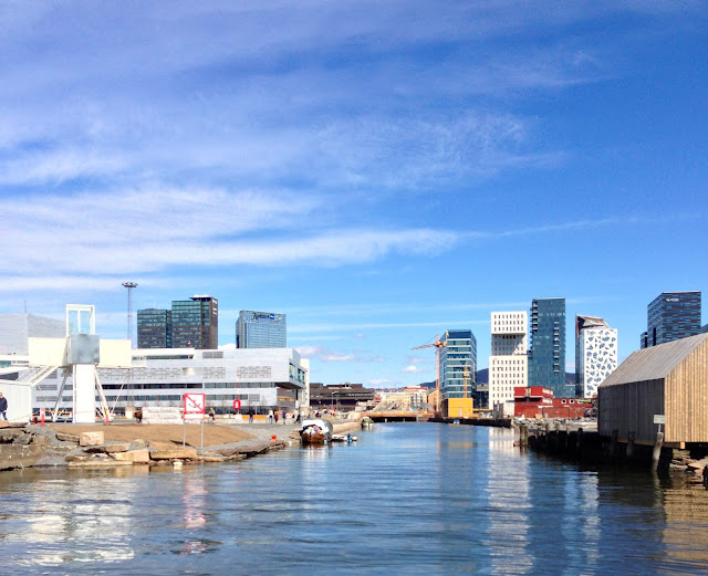
Sørenga is a neighborhood in"The Old City" of Oslo. It is located east of Bjørvika, west of Vannspeilet, south of the street Bispegata and Oslo torg, and west and north of the Alna River. South of the area the Sørenga-pier runs out into the Oslo Fjord.
On the western side of Bjørvika the Art Nouveau building Havnelageret , the towers at Oslo City Hall and Vettakollen can be seen
Vettakollen is a hill and neighbourhood in the borough of Vestre Aker in Oslo, Norway. The hill lies west of Sognsvann and southeast of Voksenåsen and Holmenkollen, and measures 419 metres above mean sea level. The built-up residential area south of the hill is served by the Oslo Metro station Vettakollen.
The name stems from the beacon hill's former use as the site of a beacon (Norwegian: varde). Before modern times, such beacons were set alight on a series of hills to constitute an alarm system. The naming is found in other hills, such as Vardåsen, Varingskollen and probably Brannfjell. Vettakollen is the hill rising from our cottage towards Holmenkollen.The areas around Bispegata and Bispevika are still a building area, but this nice bridge gives an easy access to Sørenga from the Opera House.
It is also in this area that the new Munch Museum LAMBDA have to be located. (if only the politicians can stop discussing and start building.)
Lambda is also the L-letter in the Greek alphabet
The bridge gives you a nice view up the estuaries of Akerselva.
Akerselva, or Akerselven, is a river which flows through Oslo. It starts at Maridalsvannet in Oslomarka, and follows the urban areas Nordre Aker, Sagene, Grünerløkka, Oslo centre and Grønland, whereby it finally ends at Paulsenkaien and Oset in Bjørvika. The river is considered to be a part of the Nordmarkvassdraget, and has the watercourse number 006.Z. The entire river is about 8.2 kilometres long, and has a difference in altitude of approximately 149 meters.
Maybe the Owner: Mexican yachtsman Albert Bailleres, 74 year old billionaire, who's inherited wealth (5+ billion dollars) originating from logging and mining enterprises, wants to spend some of his fortune in Oslo and Norway.
My last photo of today´s walk is from Albert Bistro stolen from their FaceBok profile. Congratulation with the reopening of a completely new restaurant. Not much is left from the old Albertine and I look forward to visit you another day.


No comments:
Post a Comment